17 January 2011
The first marine plan in covering much of UK waters in the southern North Sea will start its two year planning process from April.
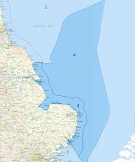
Officially termed the Eastern inshore and offshore areas, workshops held by the MMO recently in Peterborough, Norwich and Hull signalled the start of engaging with stakeholders, firstly to inform how the public engagement process will take place.
In contrast to the ongoing marine conservation planning process, where hard lines are drawn on charts to delineate MCZ boundaries within which conservation based management measures will be applied, it is less clear how the final marine plan will affect the fishing industry. As on land, however, plans are expected to be directional rather than definitive in determining what happens where, and marine licensing will continue to form the final process for permitting most marine projects and developments.
As an industry with one of the deepest maritime traditions, it is the need to accommodate increasing numbers of other marine uses that is the concern to our industry and the marine planning itself does not change that fact. However, undertaken correctly marine planning should systematically balance these multiple use needs, minimise conflict and find synergies between different uses which would signal a departure from the more ad-hoc and sectoral based approach of the past.
Whilst fishing does not occupy the majority of marine space as the conservation lobby assumes – best estimates are between 5 and 21% for bottom towed gears in English and Welsh waters1 – its diversity and heterogeneous distribution relative to other activities poses greater challenges when balancing against other marine use priorities. As well as working directly at the policy level to see that fisheries are reflected effectively in policy and planning decisions, the Federation is addressing this through two major initiatives:
- With the support of the Crown Estate, the Federation is pooling together multiple and disparate data sets on fishing activity and industry and industry held data to produced a verified set of fisheries mapping to inform marine planning processes.
- Working to see that fisheries data is most effectively analysed in order to inform the consequences of fisheries displacement should fishing be restricted in a particular area. This includes both the economic and social consequences as well as the ecological consequences of displacement.
As with the ongoing marine conservation projects, developing marine plans will have a significant stakeholder engagement element. There is no getting away from the fact that relative to other areas of policy making, such processes are resource intensive and in particular for the fishing industry require much local level engagement to facilitate the mosaic of interests in any region.
Dale Rodmell, NFFO Assistant Chief Executive said: “In contrast to the rushed “on-mass” approach to planning Marine Conservation Zones, government has set about developing marine plans in a more considered way by focusing upon one region at a time. It is essential in developing the plan that the MMO recognises the need to protect access to fishing grounds, maintain viable fishing ports and livelihoods and minimise environmental impacts to fisheries. It also needs to design an engagement process that caters for the input from the fishing industry, recognising its diversity and that input will come from people giving up their time running their everyday businesses”.
1. Eastwood, P. D., Mills, C. M., Aldridge, J. N., Houghton, C. A., and Rogers, S. I. 2007. Human activities in UK offshore waters: an assessment of direct, physical pressure on the seabed. – ICES Journal of Marine Science, 64: 453–463.